Perhaps the question is a bit confusing -- and I asked previously in a very old thread (somewhat related but about CSV), and you maybe quite busy in the office too.
So here goes again.
I have some simulation outputs for my vehicle on track(s). It displays an optimum line around the track. It creates a "Heat" line showing brake and accel points and simulates the engine profile/aero to get to speed. That then is output (as a CSV) and filed on a Google Earth (GE) map (Kap file I believe). This is a sample (JPG) of the output:
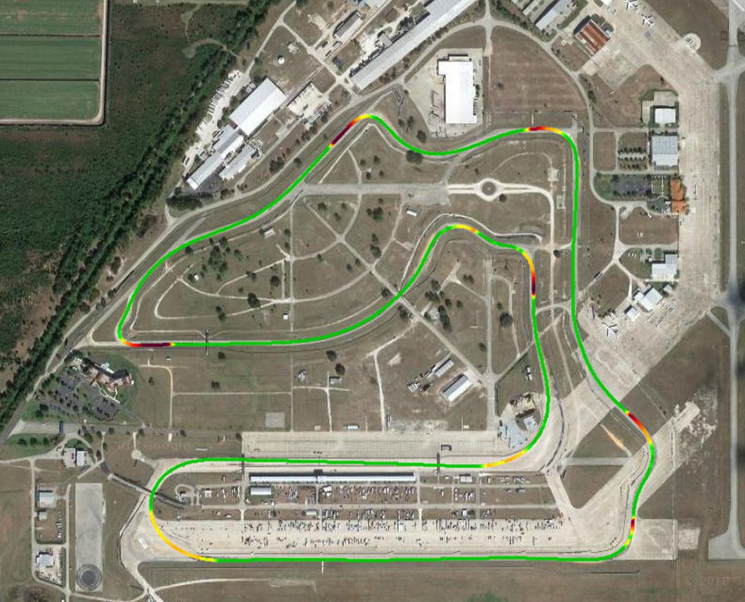
- RACEOPTIMAL SEBRING.jpg (172.75 KiB) Viewed 11943 times
I'd like to use that GE file for my Race Technology Analysis background map. Is there a work around to put that GE in as background (not the online version) and plot my sessions from my DL-1? From my sailing experience, I use offshore navigation programs can import GE files and register with nautical charts and then plot live or "recorded" GPS data. Initially it took some workarounds to "register" the GE images with the nautical charts, but now is virtually automatic.
Obviously, with a lot of paper I can compare the simulation output lap by lap with the RT by long hand, stubby pencil method, but certainly prefer a more direct approach using RT Analysis.
TIA - Cheers - Jim